 Data Analysis & Viz
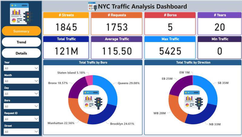
Traffic Flow Analytics Dashboard
Interactive dashboard for real-time traffic flow analysis and visualization using Power BI. Analyzes patterns across multiple junctions with predictive insights.
 Data Analysis & Viz
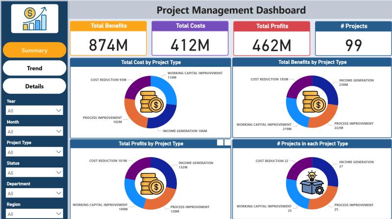
Projects Management Dashboard
The Project Management Dashboard provides an interactive overview of key performance indicators, including total benefits, costs, and profits.
 Data Analysis & Viz
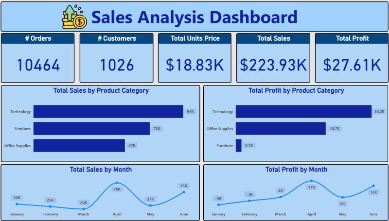
Sales Analysis Dashboard
The Sales Analysis Dashboard provides an overview of sales performance, highlighting key metrics such as total orders, customers, sales value, and profits.
 Data Analysis & Viz
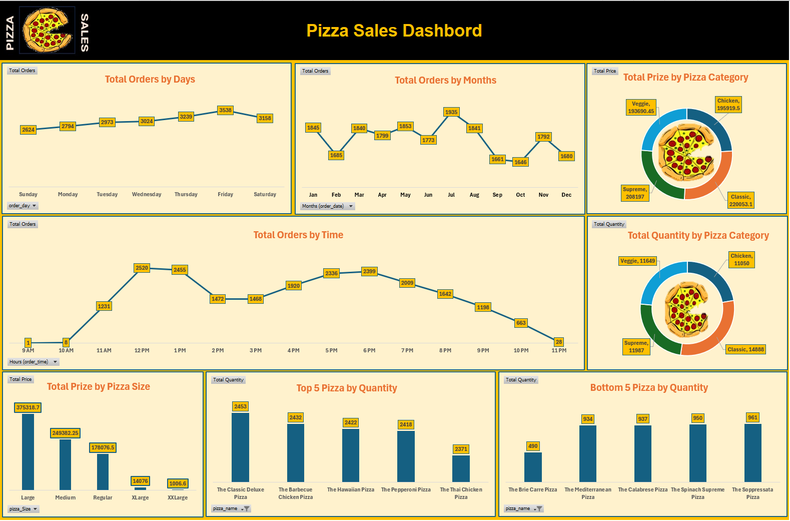
Pizza Sales Analysis Dashboard
This Dashboard provides a comprehensive overview of sales performance across multiple dimensions including time, product categories, and sizes.
 Web GIS Development
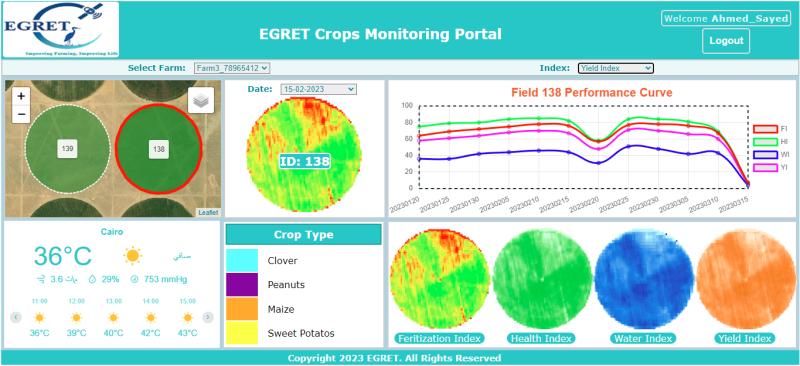
EGRET Crops Monitoring
By leveraging remote sensing data and advanced analytics, EGRET provide farmers with real-time, actionable insights on crop conditions, water management, fertilization, and yield projections.
 Web GIS Development
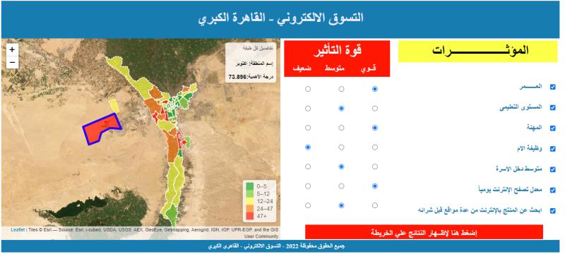
E-Marketing Site Selection Platform
Interactive mapping platform for e-marketing site selection in Cairo and Giza, enabling client participation through collaborative GIS tools.
 Web GIS Development
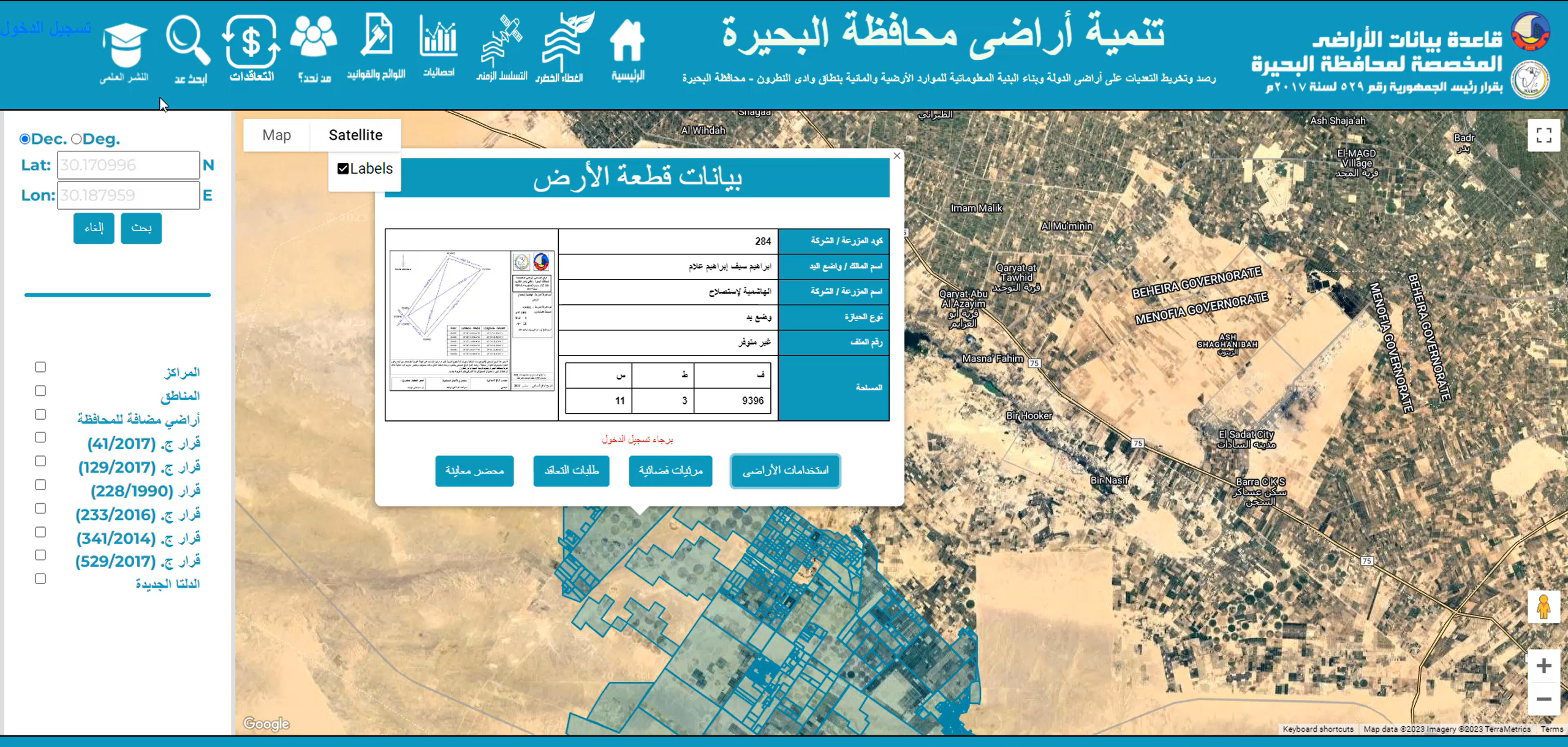
WebGIS Decision Support System
Comprehensive WebGIS platform for Wadi El Natrun rural land management with decision support capabilities and spatial analysis tools.
 Web GIS Development
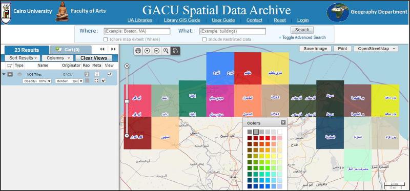
GACU Geoportal
GACU Geoportal is an open-source, GIS-Based Maps Archiving System to discover, preview, and retrieve rapidly geospatial data from multiple repositories.
 Web GIS Development
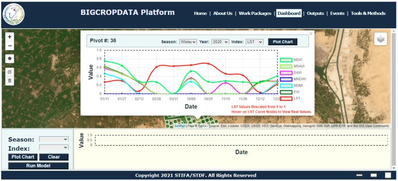
BIGCROPDATA Platform
BigDataCrop is a novel web based system to estimate and monitor the crop bio-physiological parameters as well as yield prediction and irrigation water needs.
 Mobile GIS
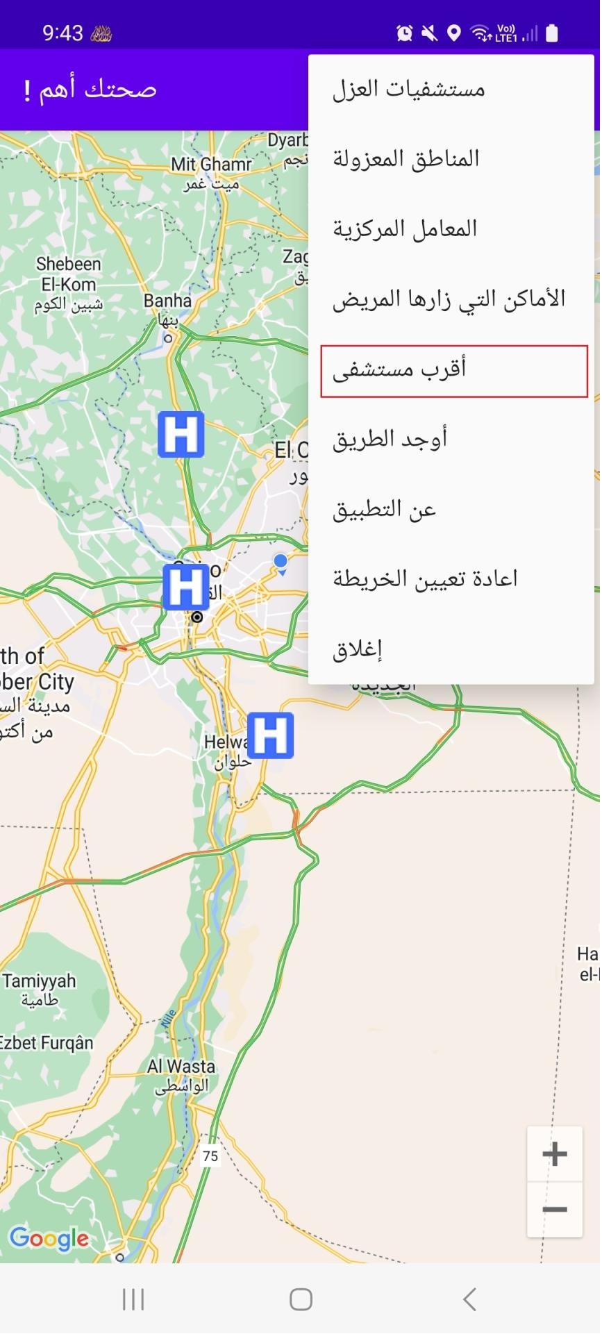
Corona Virus Tracker
A Mobile Application for tracking Corona Virus. This App has the following features.